Thursday 15 December 2016

New Nick Crane Story Map for UK Landscapes

ESRI have been working to produce a StoryMap, using the Cascade template, which has been designed to go along with the new book by RGS President Nicholas Crane.
The book tells the story of the British Landscape, and how it came into being.
Click the tabs at the top of the map to find out more about a range of topics:
  • Edge Land
  • Climate Change
  • Island
  • Altered Earth
  • Fields
  • Forts 
  • Towns
  • End of Wilderness
  • Street Plan
  • Heat Island
  • Into Space
As Nicholas says at the start of the book, to care about a place you have to know its story.
This would be great for GCSE Geographers needing to know more about the distinctive landscape of the UK.


Sunday 11 September 2016

New Discover the World video resource on the Eyjafjallajokull eruption

Good to see Simon Ross, co-author of the OCR 'A' and 'B' textbooks from Hodder presenting this new video case study by Discover the World.

Monday 5 September 2016

New British Red Cross resource now published

A new resource that I wrote for the British Red Cross has now been published, and placed online for download. It's taken almost a year from the original start of the project, which John Lyon asked me to do before he retired from the GA. During that time it has grown and become a major resource.

It's 130 pages long, and packed with ideas for teaching about natural hazards and humanitarian aid.

Free to download from the British Red Cross website.

“We urge all geography teachers to download this free resource and encourage young people to think about the humanitarian impact of natural disasters. This invaluable resource pack has been created with the technical input from the British Red Cross combined with the expertise of GA teacher consultants.”
Rebecca Kitchen, Secondary Curriculum Leader at the Geographical Association

Introduction and curriculum links

Learn about how the resource has been designed to support your teaching and how the content maps to the geography curriculum for KS3, GCSE and A Level.

Session 1: Natural disasters

Session 1 is an introduction to the Natural disasters: earthquakes resource. It sets the scene by introducing the topic of natural disasters alongside general ideas of risk and hazard.
  • What do we mean by natural hazards and disasters and how can they be classified?
  • Which natural hazards are the most common?
  • What impacts will different natural disasters have on individuals and communities?

Session 2: Earthquakes

After a general introduction to natural hazards and disasters, this session moves on to look more specifically at earthquakes, with a focus on tectonic hazards.
  • Where do earthquakes happen, and why?
  • What were the causes of the Nepal earthquake?
  • How can people who live in areas prone to natural hazards prepare themselves for future events?
  • Could the Nepal earthquake have been predicted?

Session 3: The impact of a natural disaster

Session 3 focuses on the immediate aftermath of a natural disaster like an earthquake and the work of local and international Red Cross teams to support people affected.
  • What was the immediate impact of the Nepal earthquake?
  • What was the immediate humanitarian response to the earthquake?
  • How were local and international communities involved in this response?

Session 4: Recovery and resilience

After a natural disaster the Red Cross supports the people affected as they start to recover and rebuild their lives.
  • What are the longer term impacts of a natural disaster and how do people recover?
  • How resilient were individuals and communities in Nepal to the earthquake?
  • How can communities increase their resilience – what about the school community? What might make a community more or less resilient?
  • What lessons can be learned from each event so citizens are better prepared for them in future?

Friday 12 August 2016

Sunday 7 August 2016

Crystal Serenity - the Arctic as a fragile environment

This post has been in draft for a couple of months, and the story has evolved since it was first announced. This would now be a useful idea for exploring fragile cold environments.

I'm going to try to develop this as an evolved case study piece, but ran out of time… will come back to this I think

I've just read a Jonathan Franzen piece on Antarctica in the Times which was excellent and worth hunting out...

The Crystal Serenity is a large cruise ship, which is going to boldly go on a voyage this summer, setting off in August 2016… and it's one that all geographers should be fascinated by. The ship is going to sail around the north of Canada, and go through what would have been referred to in the past as the Northwest Passage.
The ship's website has a range of detail on the voyage, which includes the itinerary and the route that the ship is going to take. I won't put it here due to copyright, but it's well worth hunting out and taking a look.

The voyage is rather expensive too (at over $20 000 per person), as all Polar voyages are, and apparently all the places have been booked.

This has attracted a lot of interest given the size of the ship, and also the nature of the voyage, which is a commercial voyage through an area which is being changed by human activity, and the ship may well cause other interruptions to daily life for people who live in the area.

The ship will be accompanied on the voyage by the BAS ship Sir Ernest Shackleton.
This has a heavily armoured hull which can withstand ice, and will also be able to have a
range of additional equipment and potentially help with an evacuation if there is a problem with the cruise ship. There has been some criticism of a scientific ship being used in this way.
There is a Canadian radio show here which includes a useful 30 minute report on the proposed voyage, although it won't be there for ever.

The Guardian has published an article on the voyage, which provides some useful additional information.

However, Klaus Dodds, who specialises in geopolitics has pointed out that there are lots of different perspectives at play in the Arctic, and this is just one of them. This is excellent on how Nunavut and Cambridge Bay is preparing for the visit.

And via Twitter, I came across a useful few tweets with ideas that are relevant, including from people living in the area.

A Pew Trust research report also contains some very useful diagrams and data on the growing changes in the Arctic.

There's a splendid infographic on this National Post article.

And finally, there was a report published recently on the sustainability credentials of cruise holidays, and the impact of these large ships on the sea through which they sail.

Saturday 23 July 2016

New 'A' level book gone to print

Not GCSE I know, but this is where you go next...

After two years and thousands of hours of effort, the 'A' level textbook for the new AQA specification has now gone to print. It will be published by Cambridge University Press. This is great news, as it means that the book will now be out several weeks before other similar books, and also ahead of the end of the summer break, so teachers will be able to have access to it in the crucial few weeks before the start of the new academic year.

I was the series editor for the book, and also the associated materials. You can see the names of the author team on the cover image below - a great team, helped by a large team from CUP.


You can find out more about the book (and order your copies) here.

Tuesday 31 May 2016

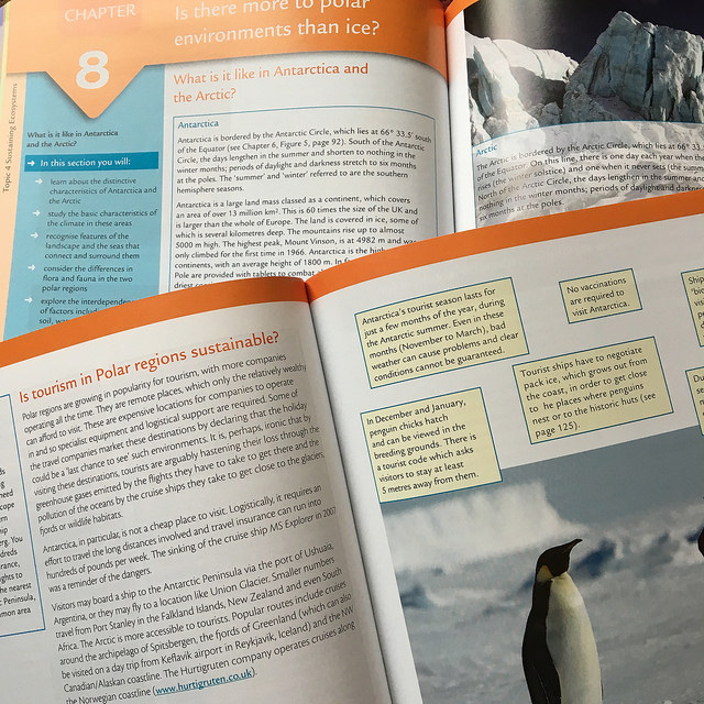
New GCSE Textbook for OCR B now out


It's now just over two and a half years since I went to a meeting at the offices of Hodder down in London, to start the process of writing a set of textbooks and support materials for the then-as-yet-written OCR GCSE Geography specifications for first teaching from September 2016.
The authoring team of Jo Payne, Jo Debens and myself were joined by Simon Ross, and we had the editing talents of David Rogers helping to steer the project, as well as Ruth Murphy from Hodder and numerous editors and other publishing professionals at various points during the project. Earlier today, the postman brought me a package, and I finally held the results of hundreds of hours of effort in my hand.


I wrote quite a few chapters in the end, and also helped to create the digital support materials, and the answers to all the various activities that have been included in the book. These all form part of the support materials that are available.


More details about the books are here, where you can find out about the various options for ordering. There are various options for discounts and inspection copies if you look at various sections of the website.

Thanks to all those who helped me with writing the books in various ways, including Ian Ward, Bryan Ledgard and Richard Allaway for the use of their images in my chapters. I managed to get quite a lot of my own pictures in, which was nice.

If you're teaching OCR specification for GCSE, please consider making our book(s) your set text. Order plenty just in case… It would be a pity for it not to sell a lot after all that effort...

Saturday 28 May 2016

14 000 views

Not that many compared to my other blogs… but thanks for reading anyway…
It's been a few years now since the Badger book came out, but I think it's still available...

Wednesday 6 April 2016

British Red Cross resource - coming soon

Amongst all the other stuff that I'm doing at the moment, is a resource that is currently half way complete, and which I hope to complete before the end of the month. It's a new resource toolkit on natural disasters for the British Red Cross, which has a focus on the Nepal Earthquake, but looks at the issues linked to humanitarian aid by agencies, particularly the work of the British Red Cross, following natural disasters. It explores the impacts over time, and has resources for KS3, GCSE and 'A' level students.

Here's one of the resources that I came across during my research below. You can search this blog for more on Nepal as well using the box in the top left.

I'm grateful to Rachel Hay for her substantial support and sharing her own personal story of being in the earthquake.

Here's another traffic CCTV video too, which shows the everyday traffic before the earthquake.

 I'll let you know when the resource is available, and how you can get hold of it.

Wednesday 23 March 2016

Something to read for those aiming for a top grade...


Earlier this week, I received a preview copy of the latest book by Danny Dorling and Carl Lee.
The book is called ‘Geography’.
Published by Profile books, this is the latest in a series of books which explore topics, in a similar (but completely different) style to the successful ‘Very Short Introduction’ series, and have previously explored ‘Politics’ and ‘Social Theory’ for example.
Geography is of course impossible to pin down easily in one small book, as it has an ambition which is ‘absurdly vast’, as Alastair Bonnett said in his own book on the subject, but Danny and Carl give it a good go.
The introduction sets the scene for the story to come, exploring the rapidly changing world which geographers try to explore, and tell the story of through their work. In my teaching, I am always looking for the compelling narrative that will draw learners in, and provide opportunities for them to reach their own informed conclusions.
The first chapter in the book: ‘Tradition’ explores the development of geographical thinking, and introduces some of the key ideas that lie behind the subject, and provide the distinctive nature of what it means to use a ‘geographical lens’ to examine the world. It takes the reader on interesting diversions to Damascus, DNA trails, the contested introduction of the term ‘Anthropocene’, Potosí, Sir Joseph Banks and the sad decline of British coal mining.


Geographical questions are never stand-alone. All the questions we ask lead to other questions. Often the answers are elusive. Geography is about joining up the dots that help make up the big picture. Connections are everywhere. The distinction between human and physical geography is often a false schism: they are intimately connected, the unifying factor being the energy that flows through all that we do, see and know.

The book is structured around a series of chapters exploring some key geographical ideas which, when connected, help to explain a lot of the world’s functioning.
Globalisation, Equality and Sustainability are these three big ideas, and there are plenty of brief vignettes to help illustrate each of them in the chapters that follow. These provide food for thought, and prompts for investigations with students (this would be a perfect summer reading book for those about to embark on a course of geographical study – perhaps Year 11s who are about to start one of the new ‘A’ level specifications in September).


There are some similarities in themes to Carl’s previous book ‘Everything is connected to everything else’, which was arguably even more ambitious and sprawling, and is available online here. (I recommend you check out the website if you haven't already seen it)

The book ends with a chapter called ‘Mapping the future’, which connects with one of the other strengths of geography. It is a subject which connects with the future, as well the past and present. It explores themes of environmental protection, global population growth and other challenges (and opportunities) facing the planet.

The book has a few black and white images but, as with all Danny Dorling’s books there are plenty of supporting web resources. These include links to large versions of the new maps that Ben Hennig has produced for the books, including one which is very useful for those exploring globalization as it shows the route of ships from Dalian in China to the ports of Europe.

There's also a section of useful weblinks, which I'm pleased to say gives a mention to this very blog.... and puts me in esteemed company too...

Thanks to Carl for sending me a copy in advance. It was a swift and enjoyable read, which opened up some nice avenues to explore further, and I’ve passed it on to my colleague to enjoy. Definitely one for the geography library for your department, or for your shelves at home.

Wednesday 20 January 2016

Time for Geography

A new blog has been started for Geography teachers, and no it's NOT one of mine...
Time for Geography has been put together by the three Parkers: Rob, Tim and Howard.
It's a nice looking site, and promises a range of resources including videos and exam support materials.


You can also follow the @timeforgeog Twitter feed. There is also a Facebook page that you can like for updates.

I look forward to seeing how the site develops...

Sunday 17 January 2016

Ben Hennig at Berkhamsted

There's a chance to see the wonderful Ben Hennig (and his cartograms) as he is speaking at the GA's branch at Berkhamsted school later this week. It's free to attend the event.


Tuesday 19 January 2016, 7pm Centenary Theatre, Berkhamsted School
Dr Benjamin Hennig: Visualisations of the Anthropocene –   investigating humanity’s impact on the Earth

Ben Hennig joined Oxford University’s School of Geography and the Environment in September 2013 as a senior research fellow. He works on spatial data analysis and geovisualisation. His research interests include social and spatial inequalities, humanity's impact on Earth, global sustainability and new concepts for the visualisation of these issues. Ben was educated at the Universities of Cologne and Bonn and the Alfred Wegener Institute for Polar and Marine Research. After working as a research assistant and departmental lecturer in human and urban geography at the Urban and Social Geography Working Group of the Department of Geography, University of Cologne (Germany) he joined the Social and Spatial Inequalities Research Group at the University of Sheffield (UK) in 2008 where he completed his PhD in 2011 as part of the Worldmapper project with research on visualising the social dimensions of our planet. He then worked as a research assistant and then as a senior research fellow at the Department of Geography in Sheffield before he joined the University of Oxford. Further information about his work can be found on his personal website: www.viewsoftheworld.net

All lectures are held in the Centenary Theatre of Berkhamsted School (Kings Campus), Kings Road, Berkhamsted, HP4 3BG. Entry is free.

I worked with Ben on a number of projects, including the LondonMapper project - check that out.....


Image created by Benjamin D. Hennig. You are free use the material under Creative Commons conditions (CC BY-NC-ND 3.0)

Monday 4 January 2016

UK Blog Awards

Voting for these awards is now open, and you can apparently vote for my LivingGeography blog to win in the education category if you had a mind to…
Click the picture below to be taken to the voting page.
Voting is open from 4th to 26th January 2016 - thanks if you vote for me - I have no expectation of winning, but you've got to be in in to win it...

Sunday 3 January 2016

Get involved with #geogshare

A New Year brings with it new challenges and opportunities.

2016 brings new specifications for GCSE and ‘A’ level first teaching, alongside the last year of the existing specifications. The creation of resources for these new specifications will result in thousands of teachers duplicating effort. Local and world events will inevitably take place, which will stimulate teachers into producing resources to help students understand them.

Following a suggestion by Tony Cassidy that we could share our resources to reduce this duplication, we have come up with a range of ways to contribute to a new initiative called #geogshare which mirrors similar projects run by other subject teacher communities.

There are (at least) three ways that you can get involved in #geogshare.

1. Twitter / Blogs

Post a link to a resource, or a blogpost where a resource has been shared

Use the hashtag #geogshare when you post it, so that a search will bring it up, and they can also be storified from week to week, and shared here.


2. DROPITTOME

Drag and drop a resource or two into the box on this page:

https://dropitto.me/GeoBlogs


You'll need to DM on Twitter or e-mail for the password

This will send your resources automatically to the 3rd (and perhaps the preferred and most sustainable) option.

3.

A GEOGRAPHY DROPBOX has been set up at:

https://www.dropbox.com/home/GEOGRAPHYDROPBOX

again, e-mail myself or Tony Cassidy, or DM us on Twitter to be added to this folder...

This will give you access to the folder, and the ability to edit and add materials, as well as download copies for yourself.

You will find a series of folders, which you can place materials into to help organisation.

There is a link to a Google Doc, which can also be viewed here

https://goo.gl/N7n1UM where you can place details of the resources that you are adding, which will allow you to search for relevant resources as the Dropbox (hopefully) starts to fill up.

We would like to suggest that you post one resource a month, but feel free to post more frequently (perhaps once a week) if you feel able.

Perhaps you could add ‘contribute to #geogshare’ to your New Years resolutions.

Another year for standing on the shoulders of giants.